


NBC6’s Adam Berg has your forecast for today, Thursday, Sept. 26, 2024.
Hurricanes are most know for the wind, surge and rain threats that come with them. But there is another very common threat that arrives in the outer rain bands–tornadoes.
Hurricane Helene, on its way toward the northwest coast of Florida, has already prompted tornado warnings Thursday, and tornado watches remain in effect until 8 p.m. across all of South Florida.
HURRICANE HELENE

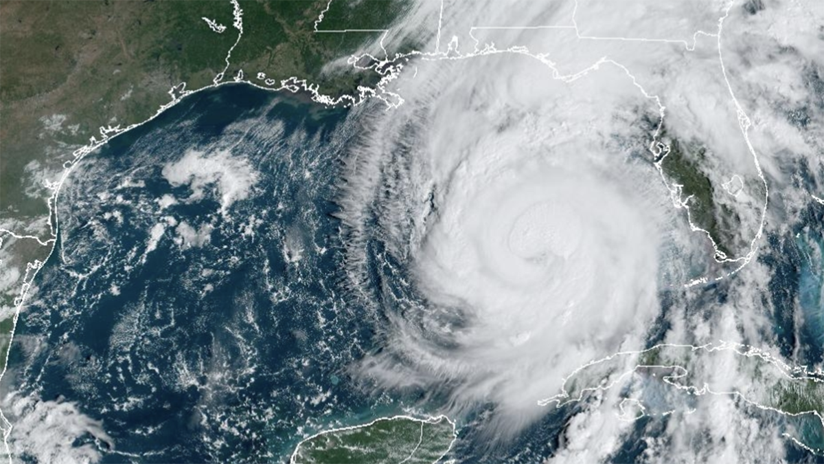
Though a direct impact is not expected in South Florida, the region is still feeling the impacts of the storm that is expected to make landfall as a Category 3.
The Hurricane season is on. Our meteorologists are ready. Sign up for the NBC 6 Weather newsletter to get the latest forecast in your inbox.
Tornadoes are typically found on the eastern side of the hurricane, and in fact it is known as the strongest side, or "dirty" side, of the system.
In South Florida, it is common to see waterspouts, but tropical tornadoes are formed with the elevated wind shear that comes as the outer band, known as squall lines, move onshore.
The outer bands shoot off and away from the center of circulation, and they are moving quickly. As they move onshore, the wind at the surface begins to slow down. But higher in the atmosphere, the wind remains strong.
This contrast is known as wind shear – a change in wind speed (or direction) at different heights in the sky. This will create quick, but frequent, spin-up tornadoes.
The change in direction comes as there is a natural counterclockwise spin from the hurricane itself, but the outer bands are moving away from the center, causing a slightly different direction of those winds.
These are typically very short-lived and weak compared to the large supercell tornadoes that come from single rotating thunderstorms.
