
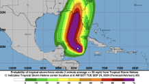
Tropical Storm Helene formed over the northwestern Caribbean Sea Tuesday and was expected to strengthen into a major hurricane as it it moved through the Gulf of Mexico on a path toward Florida this week.
Helene had maximum sustained winds of 50 mph and was about 155 miles east-southeast of Cozumel, Mexico, according to the latest update from the National Hurricane Center in Miami.
Once it moves closer to the Yucatan channel, it’ll have the opportunity to strengthen into a hurricane and then a major hurricane, the NHC said.
HURRICANE SEASON LATEST

The Hurricane season is on. Our meteorologists are ready. Sign up for the NBC 6 Weather newsletter to get the latest forecast in your inbox.
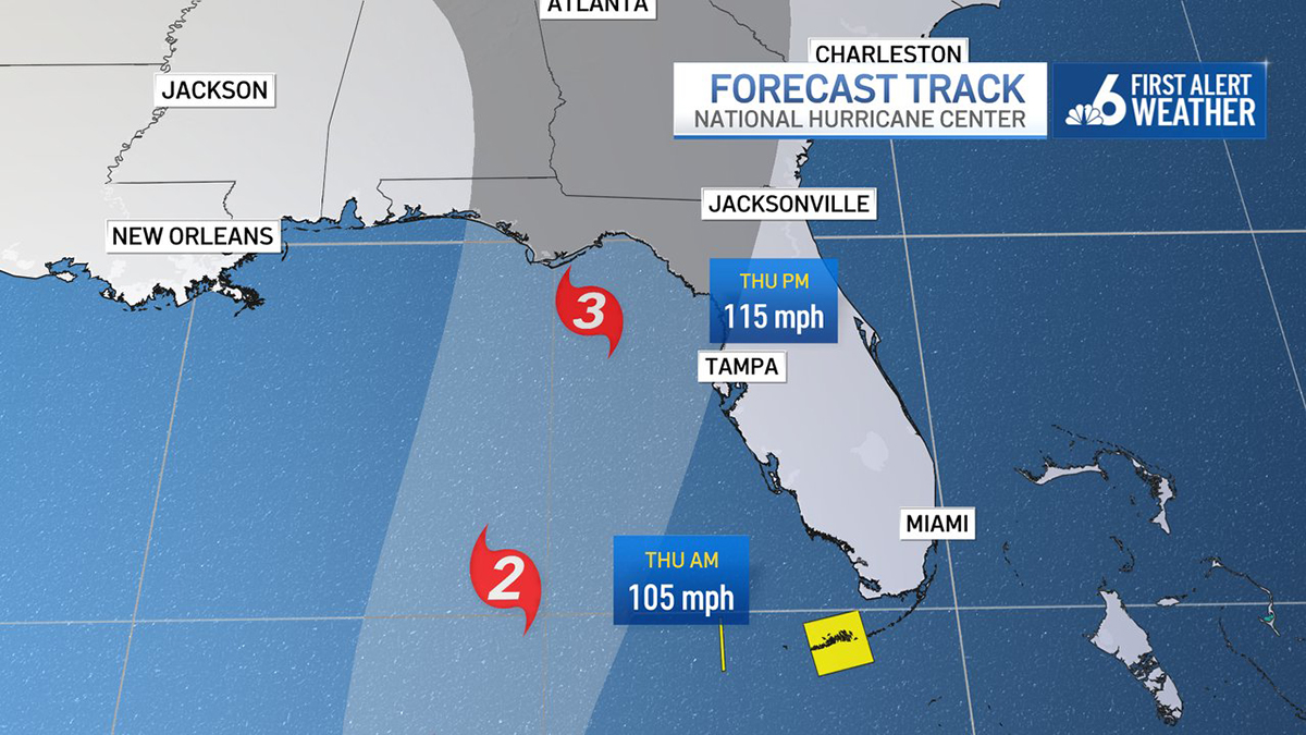
The forecast currently has Helene getting up to a major Category 3 hurricane as it approaches landfall by Thursday afternoon and evening in the Big Bend of Florida.
A hurricane warning was issued for the Anclote River to Mexico Beach, Florida, while a hurricane watch was in effect for Englewood to the Anclote River, including Tampa Bay.
A tropical storm warning was issued for portions of Florida including the Lower and Middle Florida Keys west of the Channel 5 Bridge, while a tropical storm watch was in effect for Lake Okeechobee and the Palm Beach/Martin County line northward to the Savannah River.
Storm surge watches stretched along the state's Gulf coast from the Big Bend all the way to the Florida Keys.
Florida Gov. Ron DeSantis expanded a state of emergency to 61counties ahead of the storm, as some residents began to evacuate on Tuesday.
Tropical storm force wind is expected to extend well away from the center of the storm. South Florida's wind begins picking up tonight and into Wednesday morning. TS force conditions in the Lower Keys could last into Thursday! @nbc6 pic.twitter.com/Qzm5lWpGVy
— Chelsea Ambriz (@ChelseaAmbrizTV) September 24, 2024
Major impacts
Heavy rainfall will come with this system, increasing the flooding threat. The flooding rain looks to track well inland and into the midsouth into the weekend.
Due to how large this system is forecast to be, storm surge, wind and rainfall impacts will extend well away from the center, especially on the east side of the system.
Hurricane watches are place through the Big Bend of Florida while tropical storm watches extend down into the Lower Keys.
— Chelsea Ambriz (@ChelseaAmbrizTV) September 24, 2024
This system is forecast to strengthen into a major hurricane before making a landfall on Thursday! @nbc6 pic.twitter.com/tqsImqd1iW
Timeline
Wind will begin to pick up Tuesday afternoon and evening across the South Florida area.
Outer rain bands from this system could start to move through the overnight hours on Tuesday and into Wednesday morning. Surge in the Florida Keys could be 1-3 feet as the system passes.
For South Florida, wind will be the main thing we feel across Broward and Miami-Dade counties. Gusty conditions take over Wednesday, Thursday and Friday. Wind could be sustained 20-25 mph and gust 35-40+ mph.
Scattered tropical downpours are expected starting overnight Tuesday and into Wednesday morning.
The scattered outer bands will last off and on into Thursday and lingering showers into Friday. Isolated and quick tornadoes can’t be ruled out. Rain totals should be 2-4 inches with localized areas seeing up to 6 inches.
In the Keys, winds are already starting to pick up and will continue to do so through Thursday. Sustained wind of 20-30 mph is expected with gusts of 50+ mph.
Rainfall totals will range from 4-6 inches, especially as we go into Wednesday, and this system is west of the island chain.
Rain looks to linger into the weekend. Storm surge will also be possible, with heights of 1-3 feet.