


NBC6’s Adam Berg has your forecast for today, Saturday, Oct. 5, 2024.
A tropical depression has formed over the southwestern Gulf of Mexico and may intensify into a hurricane in the next few days on its way toward the west coast of Florida, the National Hurricane Center (NHC) said on Saturday.
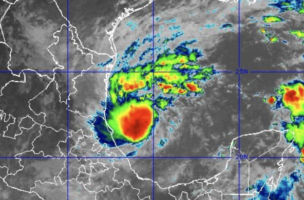
Tropical Depression Fourteen currently has maximum sustained winds of 35 mph and is moving north-northeast at 3 mph. It's located about 210 miles north-northeast of Veracruz, Mexico.
The depression is forecast to strengthen into Tropical Storm Milton later Saturday, and then into a hurricane by early Monday.
A developing system in the western Gulf of Mexico threatens to bring more water woes to #Florida. And now, potentially, an impactful windstorm too. #Invest92L could hit as a hurricane midweek on the west coast of the peninsula, putting South Florida in the active wet & gusty side pic.twitter.com/JJ1qsly3eO
— John Morales (@JohnMoralesTV) October 5, 2024
The Hurricane season is on. Our meteorologists are ready. Sign up for the NBC 6 Weather newsletter to get the latest forecast in your inbox.
The NHC said areas that could feel the storm's impact include the Yucatan peninsula of Mexico, the Florida Peninsula, the Florida Keys and the northwestern Bahamas.
Hurricane and storm surge watches will likely be required for portions of Florida, especially along the southwest coast of Florida and the Florida Keys, on Sunday, the NHC said.
The system has already started dumping rain and thunderstorms over the southwestern Gulf of Mexico. The NHC forecasts that its march will be slow, but it could become a major hurricane while it moves across the central and eastern Gulf.
Weather Stories


Well...here we go.
— Ryan Phillips - NBC6 (@RyanNBC6) October 5, 2024
11am Saturday:
-NHC calling for RI in #Milton track across Gulf, approaching FL west coast
-First call is for a strong cat. 2
-Sustained tropical storm wind probs:
FLL - 37%
MIA - 20%
MTH - 33%
KEY - 38%
-Heavy rain will be an issue #flwx #TD14 pic.twitter.com/Oos3EiAioN
Where is the tropical depression headed?
While it’s too early to definitively say where the tropical depression will track, model guidance and the NHC are hinting at the core of this system remaining near Tampa.
For more storm surge flooding, the storm would need to go to Tampa’s north. This would bring significant storm surge to Fort Myers and maybe even moderate surge to Key West, along with some gusty winds for the Lower Keys, but it would not bring anything but rain to the rest of South Florida.
What will be the impacts be to South Florida?
Expect rain from Sunday through Wednesday, with the most falling on Monday.
The cyclone will bring breezy/windy conditions to the region on late Tuesday and Wednesday.
Weather alerts like flood and tropical storm watches and warnings could go into effect.
How much rain should we expect?
The National Weather Service is estimating up to 8 inches of rain in Miami-Dade and up to 10 inches of rain in Broward over the four days, from Sunday to Wednesday. Luckily, we’ll be out of a King Tide cycle next week.
Total rainfall amounts could climb to over a foot closer to the actual center of the cyclone.
Refresh for updates.
