
Broward and Miami-Dade counties are under an excessive heat warning Saturday until 6 p.m., the National Weather Service said. This is issued when heat index values are expected to be 110 or higher for at least two hours.
At 8:46 a.m., the National Weather Service upgraded a heat advisory, which warned of high temperatures between 108-112 degrees, to the excessive heat warning with feels-like temperatures up to 113 degrees. Again, that's what it could feel like for at least two hours this afternoon.
The Florida Keys remain under a heat advisories until 7 p.m., for feels-like temperatures up to 109 degrees.
The Hurricane season is on. Our meteorologists are ready. Sign up for the NBC 6 Weather newsletter to get the latest forecast in your inbox.
While the *Excessive Heat Warning* product is always available for use, the threshold temperature is tough to achieve. @NWSMiami issued one moments ago.
— Ryan Phillips - NBC6 (@RyanNBC6) September 14, 2024
It's the first of 2024.
There were 6 issued in 2023, the most recent over a year ago, early August.
📈@akrherz#flwx pic.twitter.com/0D1ui79tHE
Fort Lauderdale tied a record-high temperature on Friday at 93 degrees, which was previously set for Sept. 13 in 2015. Miami reached 95 degrees, but the record for the date was 96, set last year.
Saturday we could near record heat again. Highs are expected to be in the low- to mid-90 degrees. The current record for Miami is 94 degrees and we’re forecasting 93. Fort Lauderdale is a little more out of reach. The current record for FLL for Sept. 14 is 98 degrees which was set in 1955.
Weather Stories

Upgrade to our heat alerts! Broward and Miami-Dade are now under an Excessive Heat Warning until 6 PM. The criteria for this is 110° for 2 hours and we could feel as hot as 113° in parts of the area. @nbc6 pic.twitter.com/1oSKGlSafe
— Chelsea Ambriz (@ChelseaAmbrizTV) September 14, 2024
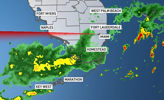
So Saturday morning will be bright and mainly rain free. But there is also a chance for more storms.
With a westerly component to the wind, the activity looks to trigger inland and then move it’s way to the east as the afternoon and evening progress.
Heavy rain could result in additional flooding across the area in poor drainage areas. Any heavy rain will bring the chance for localized ponding.
Tips for dealing with the heat
The Red Cross and the National Weather Service (NWS) have a series of recommendations for facing days with high temperatures and avoiding health problems.
- The general basic recommendation is to stay hydrated, wear light clothing, and protect yourself from the sun if you're going to be engaging in outdoor activities.
- One of the first warnings is related to vehicles, as the heat inside a car can be deadly. "Never leave children or pets in your vehicle. The interior temperature of the vehicle can quickly reach 120 degrees," says the Red Cross.
- It is also recommended to avoid excessive consumption of caffeinated or alcoholic beverages.
- If you don't have air conditioning, seek relief from the heat during the hottest hours of the day in places like libraries, theaters, and shopping malls.
- It is also advisable to avoid extreme temperature changes. Avoid exercising outdoors during the hottest hours of the day.
- Take frequent breaks if you work outdoors and check frequently to ensure that pets are not suffering from the heat. Make sure they have plenty of fresh water and shade.
Future forecast
Sunday looks to be very similar. The coverage of the storms may be a touch lower than Saturday, but still expected are afternoon showers and storms. Highs remain in the low 90s.
It’ll remain unsettled through next week.
Tropical Storm Gordon is still in the open waters of the Atlantic with no threat to land at this time. The forecast actually shows it moving into dryer and more stable air with lots of wind shear. It looks like it could weaken back into a tropical depression until meanders into more suitable conditions to regain momentum.
The other area being monitored off the coast of the U.S., low chance of development in the next two days, medium chance of development in the next seven days. This is along the stalled front and a non-tropical area of low pressure is expected to develop. It may take on subtropical characteristics once it moves into the gulf stream in which a tropical depression may develop next week.