
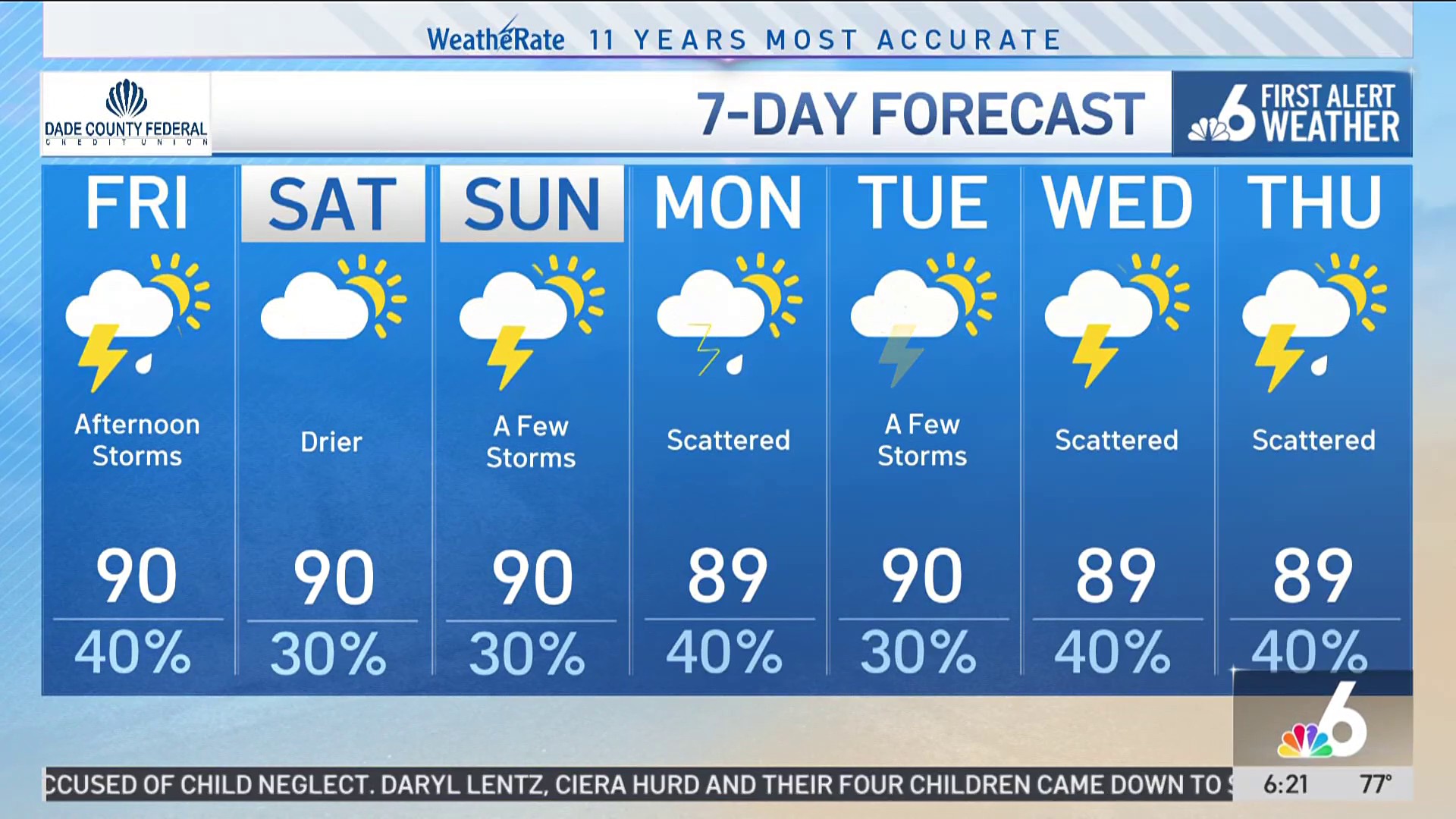
We finally see our stubborn, stormy pattern easing up this weekend. While we’ll still have afternoon storms, they are much more scattered, only in the 30-40% range, a huge improvement from this week. Sunday may be even drier, but we’ll see how Saturday plays out before lowering our rain chances.
The Coastal Flood Advisory now takes us through Saturday afternoon. Sunny-day flooding from the King Tides will continue for the next few high tides…Miami’s next two are 11:15 p.m. tonight and 11:55 a.m. Saturday.
In the tropics, all eyes are on the Western Caribbean and Gulf with an area that now has a 50% chance of tropical cyclone development over the next seven days.
Our models have been consistent in development, with "significant" development still on the table, but not certain. We still see a split in our models with the more western track essentially leaving South Florida with little or no impacts as the system tracks toward Mexico/Texas.
The Hurricane season is on. Our meteorologists are ready. Sign up for the NBC 6 Weather newsletter to get the latest forecast in your inbox.
The more-eastern solution would spread torrential, tropical rain into South Florida later next week, and then it’s a matter of if any of the wind threats make it to us.
But even this more eastern solution is slightly more west than yesterday. For that reason, the National Hurricane Center is starting to lean a bit more toward the west in their projections, which would be good news for South Florida. But we will leave all options on the table until the system actually forms and our models start to show consensus.
Weather
TONIGHT: Partly cloudy. Scattered evening storms. Isolated night showers. Rain: 30% down to 10% overnight. Low: 78°.
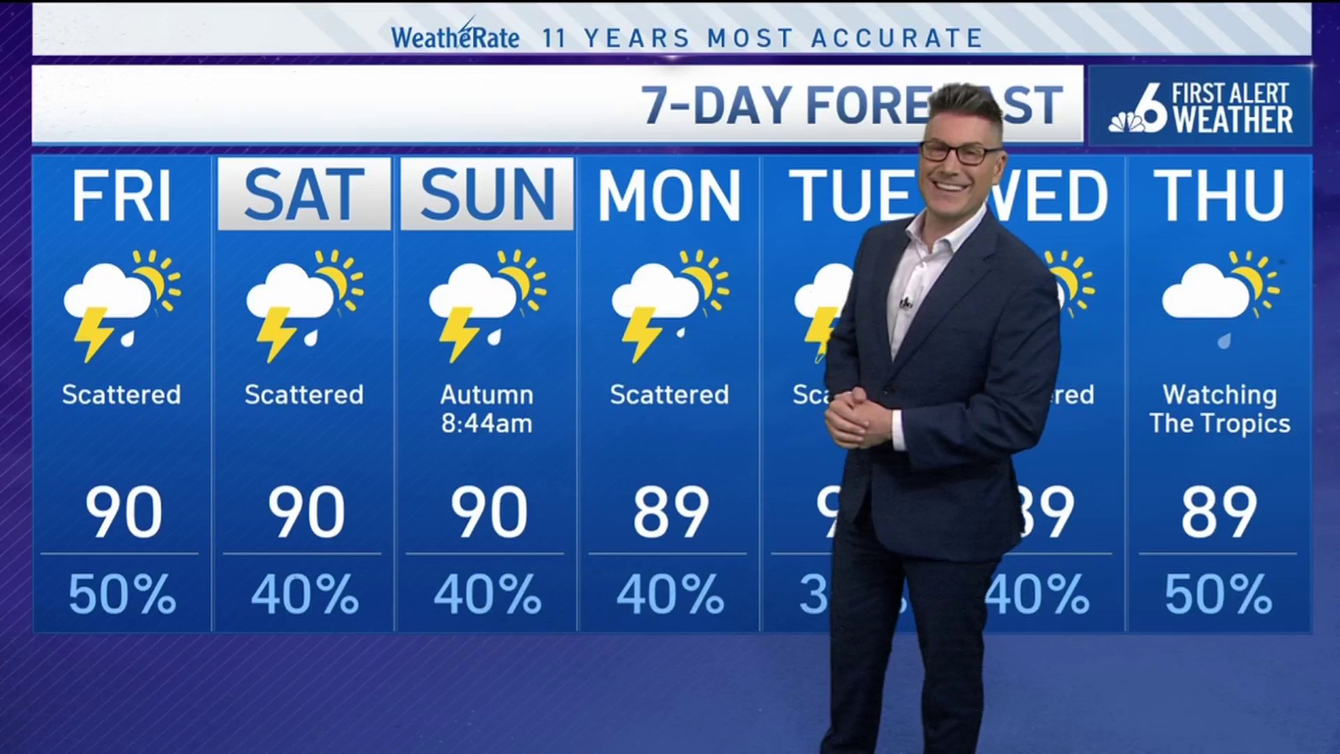
SATURDAY: Sunny. Scattered afternoon storms. Rain: 40%. High: 90°.
SUNDAY: Sunny. Scattered afternoon storms. Rain: 30%. High: 90°.
MONDAY: Sunny. Scattered afternoon storms. Rain: 30%. High: 90°.