
Our cold front has pushed through, and we are feeling it!
Temperatures have dipped into the low 70s and while that doesn’t seem like much, it is some of the coolest weather since last April and May.
The humidity is way down too, but the winds are what will likely impact you the most.
We have a high risk of rip currents in play, along with a small craft advisory as seas could occasionally hit 13 feet.
The Hurricane season is on. Our meteorologists are ready. Sign up for the NBC 6 Weather newsletter to get the latest forecast in your inbox.
This will also make this current King Tide cycle we are going through a bit more impactful. Watch for saltwater flooding around high tide for the next few days.
Lastly, we are also under a wind advisory for folks along and east of Interstate 95. Look for gusts to 35 mph+.
A far as showers are concerned, we have lowered the chances to about 20% between now and the weekend, so keep those outdoor plans… just hold on to your hats.
Weather
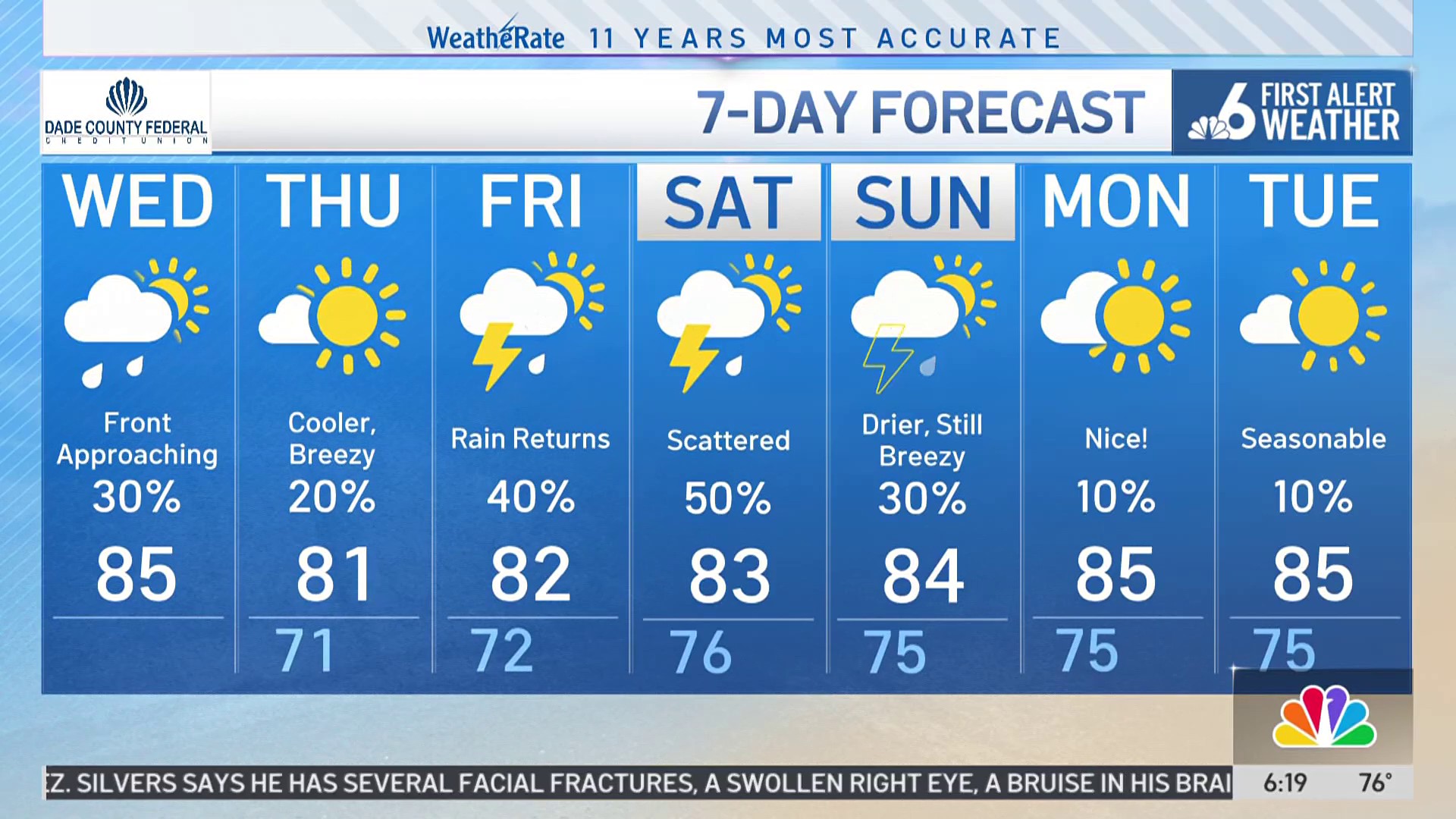
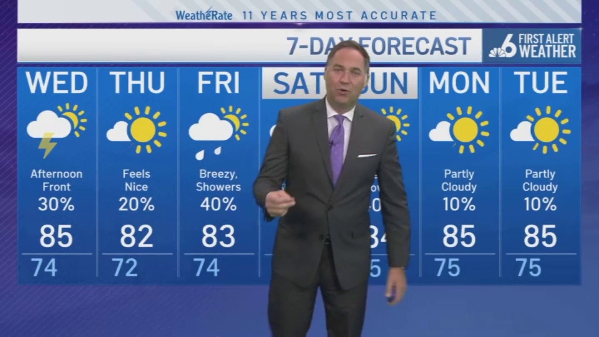
South Florida will see highs near 80 for your Thursday with a slow warming trend into the mid-80s by the weekend.
Today
Partly cloudy and gusty with low humidity. Highs near 81.
Friday
Gusty, isolated showers. Highs near 82.
Saturday
Gusty, isolated showers. Highs near 83.
Sunday
Breezy, isolated showers. Highs near 84.