


Meteorologist Steve MacLaughlin has the latest forecast Thursday, Sept. 19, 2024.
Thursday was another day that started with sunshine and ended with storms, a pattern that will continue over the next couple of days. It was nice to "not" have a heat advisory on Thursday as feels-like temps remained below the criteria.
The Coastal Flood Advisory continues for Dade/Broward/Upper Keys until 5 p.m. Friday for sunny day flooding due to the King Tides. The next high tide will be 10:30-11:00 p.m. this evening up north and about midnight for Key West.
In The Tropics, there are two areas out in the open Atlantic…the remnants of Gordon and a new area of low pressure a little farther west. Both are forecast to move north long before they get anywhere near the United States.
That leaves the area in the Western Caribbean and Eastern Gulf, where we are now up to 40% chance of a tropical depression. We will know more over the next week as our models hopefully begin to show signs of consensus and consistency.
The Hurricane season is on. Our meteorologists are ready. Sign up for the NBC 6 Weather newsletter to get the latest forecast in your inbox.
For now, we definitely need to keep a very close eye on if and how this system develops and if it tracks farther west away from us with little or no effects or farther east, where the wind and moisture effects get closer to Florida.
While it is much too early to speculate, this is certainly the first system in a while that we need to monitor in the coming days. Autumn begins on Sunday at 8:44 a.m.
Weather


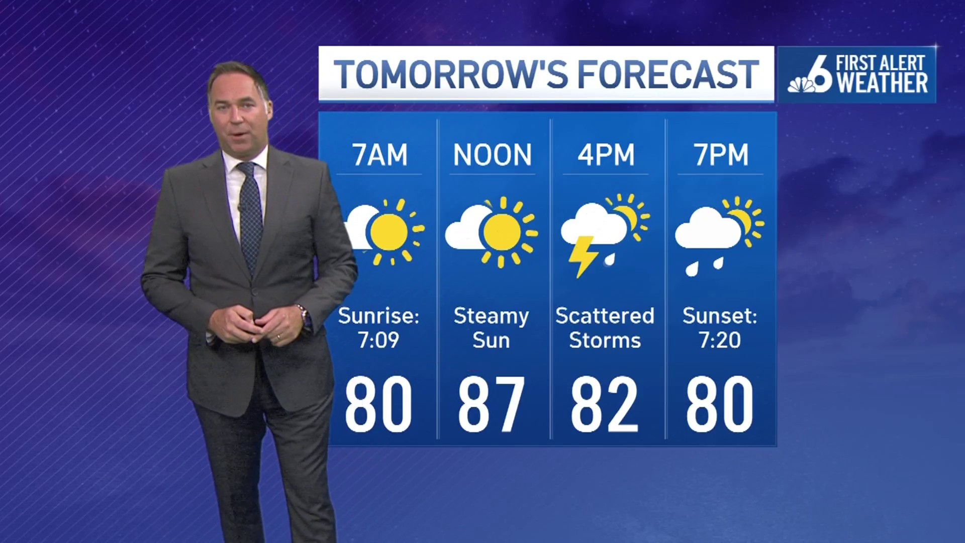
TONIGHT: Mostly cloudy. Scattered storms. Rain: 50%. Low: 78°.
FRIDAY: Partly sunny. Afternoon storms. Rain: 50°.
SATURDAY: Sunny. Scattered storms. Rain: 40%. High: 90°.
SUNDAY: Sunny. Scattered storms. Rain: 40%. High: 90°.
