


Get the latest South Florida weather updates from the NBC6 meteorologists.
Heat Advisory until 6 pm for Broward and Miami-Dade counties for feel-like temps to be 105-110. High temps today will be in the low 90s, around 93.
Morning temps have been in the low 80s with partly clear skies. Isolated showers are around the area this morning but not much has been moving onshore.
This chance for rain remains relatively low for the weekend. The heat and humidity linger with the tail end of tropical moisture as the remnants of Helene linger in the Ohio and Tennessee River valleys to our north. High pressure is building in the Atlantic which is going to help lower our rain changes even with the humidity around. Today will be the highest rain chance for the weekend which could be an isolated downpour.
Sunday, the humidity should lower just a little bit, and rain chances remain low. Lots of sunshine with highs in the low 90s are expected, feel like conditions will still be 105-110.
The Hurricane season is on. Our meteorologists are ready. Sign up for the NBC 6 Weather newsletter to get the latest forecast in your inbox.
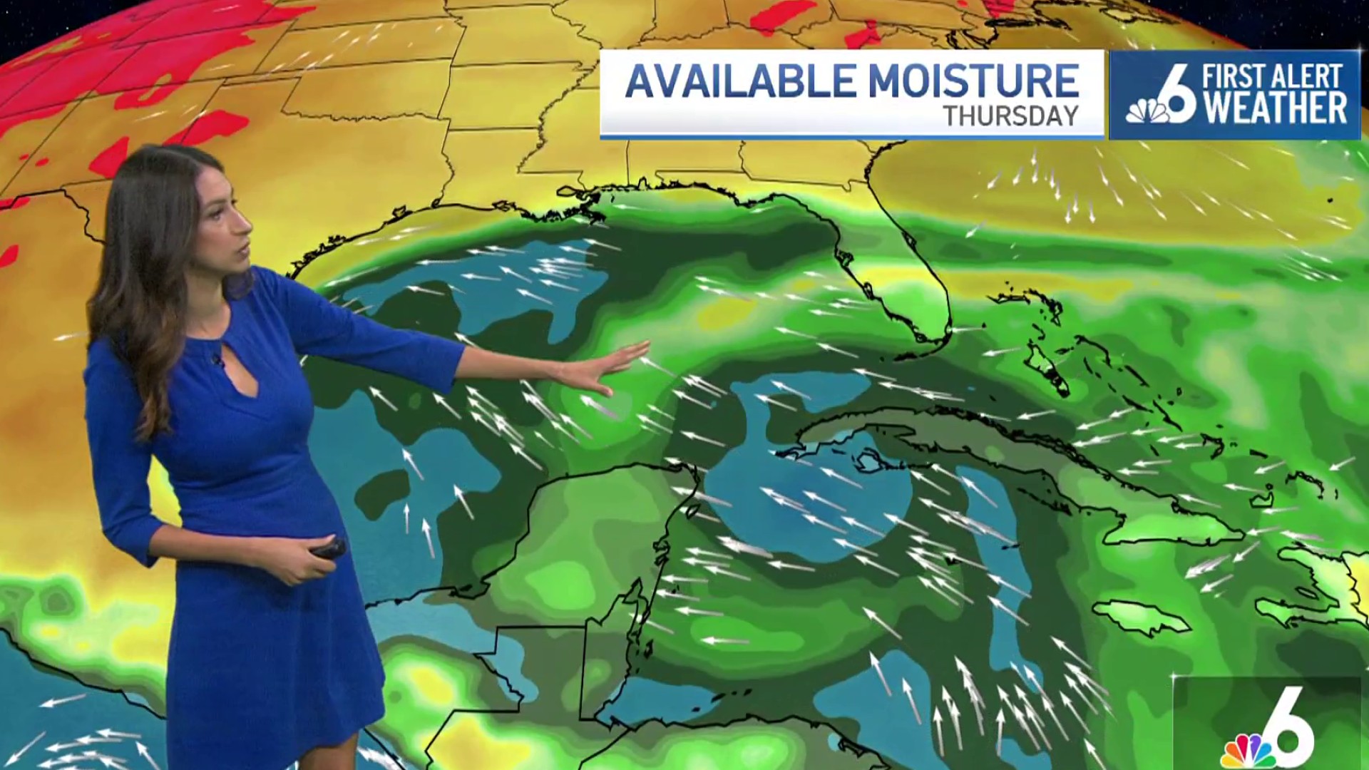
We’ll be watching the area of tropical moisture in the Caribbean Sea to the south of Cuba. This will bring back more unsettled weather for us by the middle to end of the week. Right now a 40% chance of a tropical depression developing by the middle of next week.
Hurricane Isaac and Tropical Storm Joyce won’t bring any additional impacts to us as they are forecast to stay in the open waters of the Atlantic.
Weather

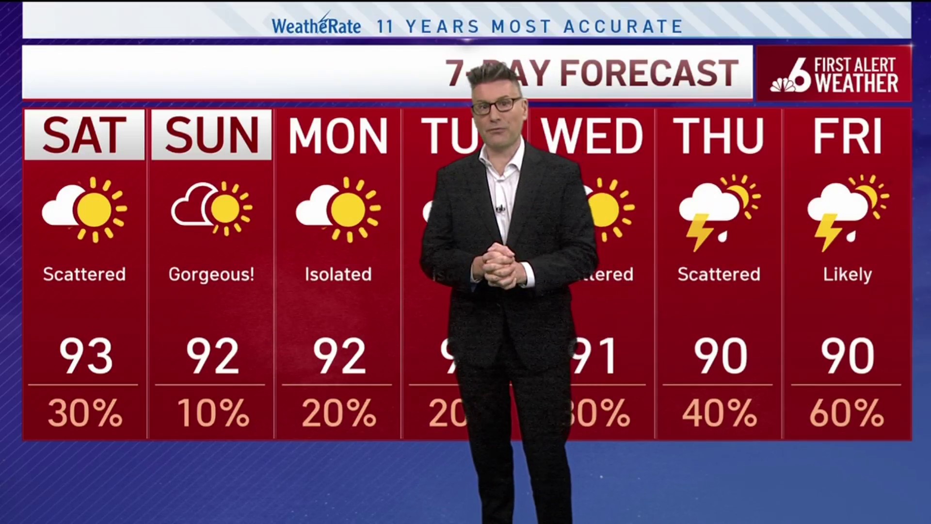
Saturday
A 30 percent chance of showers and thunderstorms. Mostly sunny, with a high near 93. Heat index values as high as 105-110. South wind 5 to 15 mph.
Sunday
Sunny, with a high near 92. Heat index values as high as 105+. Southeast wind 5 to 10 mph.
Monday
Mostly sunny, with a high near 91. East wind 5 to 10 mph. The chance of precipitation is 20%.
Tuesday
A 20 percent chance of showers and thunderstorms. Sunny, with a high near 91.
