
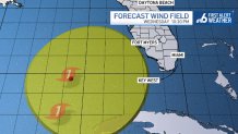
The expectation of a developing tropical system, with a wide swath of wind entering the Gulf of Mexico, prompted the issuance of a Tropical Storm Watch for the Lower Keys Monday evening.
The watch, in effect until further notice, sets the stage for the evolution of “Helene” in the northwest Caribbean Sea and southern Gulf of Mexico over the next few days.
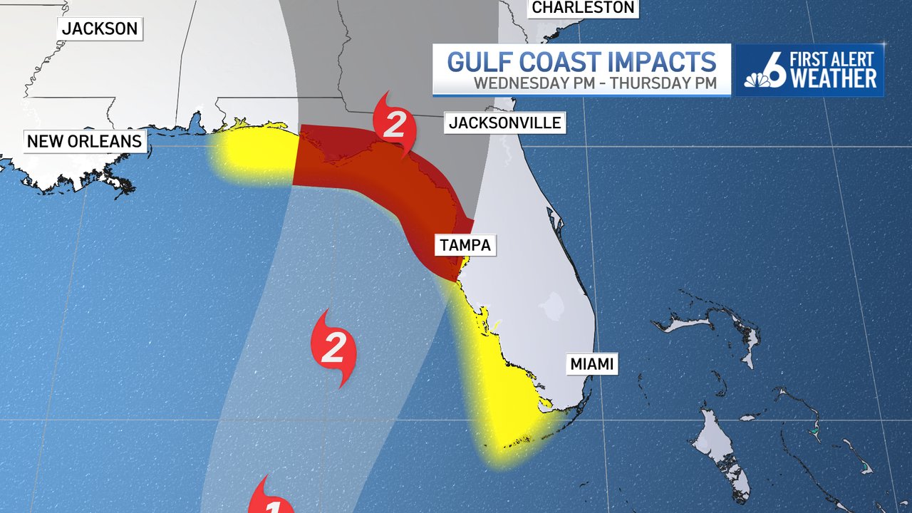
The storm, likely to grow in size and in strength, will have a large field of strong winds that could touch the Lower Keys Wednesday and Thursday.
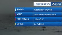
Currently the expectation is that winds could run at 20 to 30 mph with gusts up to 50 mph with some of the stronger rain bands that sweep the area.
The Hurricane season is on. Our meteorologists are ready. Sign up for the NBC 6 Weather newsletter to get the latest forecast in your inbox.
Locally heavy downpours will be possible through Thursday as rain totals of 3 to 6 inches remain possible from Marathon to Key West.
A storm surge up to two feet remains possible, based on the current track and trends. Adjustments would be made accordingly if the system tracks a little closer, or farther, from the Keys.
In metro South Florida, conditions are likely to change for the wetter on Wednesday, too. Passing downpours for the balance of the week could produce 2 to 4 inches of rain, with locally heavier amounts.
Hurricane Season
The NBC 6 First Alert Weather team guides you through hurricane season

While the winds won’t be as strong, breezy conditions with gust to 45 mph in a few rain bands cannot be ruled out. While the wet pattern sustains for the rest of the week, the weekend should yield subtle improvements.