What to Know
- Tropical Storm Idalia was gaining strength and had maximum sustained winds of 70 mph, according to the National Hurricane Center in Miami
- Idalia could approach Florida on Wednesday as a dangerous Category 3 hurricane with winds of up to 115 mph, the NHC said
- Watches and warnings were issued up and down Florida's Gulf and east coasts as mandatory evacuations were ordered for some and airport and school closures were announced
Florida residents loaded up on sandbags and evacuated from homes in low-lying areas along the Gulf Coast as Tropical Storm Idalia intensified Monday and forecasters predicted it would hit within days as a major hurricane with potentially life-threatening storm surges.
As of Monday evening, the storm was about 10 miles northwest of the western tip of Cuba and moving north at 8 mph with maximum sustained winds of 70 mph, according to the National Hurricane Center in Miami.
Forecasters said they expected Idalia to become a hurricane any time Monday night or Tuesday in the Gulf of Mexico and then curve northeast toward the west coast of Florida.
The Hurricane season is on. Our meteorologists are ready. Sign up for the NBC 6 Weather newsletter to get the latest forecast in your inbox.
Idalia could approach Florida on Wednesday as a dangerous Category 3 hurricane with winds of up to 115 mph, according to the latest forecasts from the Hurricane Center.
A number of watches and warnings were issued up and down Florida's Gulf and east coasts from the lower Florida Keys to the Panhandle.
A hurricane warning was issued from the middle of Longboat Key northward to Indian Pass, including Tampa Bay, while a hurricane watch was in effect for Englewood to the middle of Longboat Key.
A tropical storm warning was issued for the Dry Tortugas, Chokoloskee northward to the middle of Longboat Key, west of Indian Pass to Mexico Beach and Sebastian Inlet northward to Altamaha Sound.
And a tropical storm watch has been issued for the lower Florida Keys west of the west end of the Seven Mile Bridge and Sebastian Inlet northward to the South Santee River in South Carolina.
Along a vast stretch of Florida's west coast, up to 11 feet of ocean water could surge on shore, raising fears of destructive flooding.
A storm surge warning has been issued from Englewood northward to the Ochlockonee River, including Tampa Bay, while a storm surge watch has been issued from Mouth of the St. Mary's River to Altamaha Sound, Georgia.
At a news conference Monday, Florida Gov. Ron DeSantis announced that his administration had submitted a pre-landfall declaration with the federal government Sunday night. The Biden administration approved it Monday.
"I have also expanded our state of emergency, the executive order, to include 13 additional counties," DeSantis added.
This brings the total to 46 Florida counties under the state of emergency for Idalia.
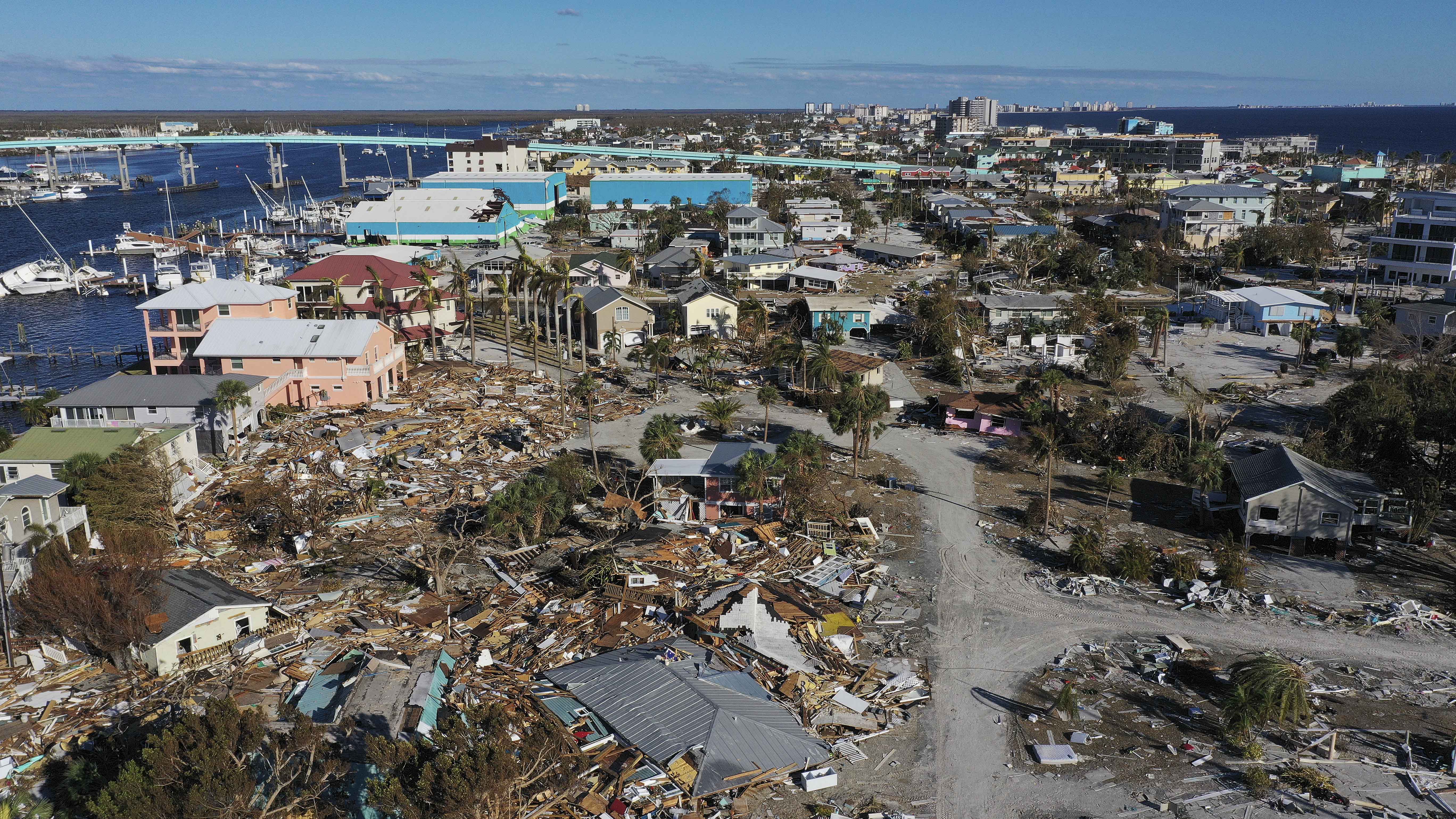
DeSantis warned of a “major impact” to the state. Idalia would be the first storm to hit Florida this hurricane season and a potentially big blow to the state, which is still recovering from the devastation of Hurricane Ian almost a year ago.
The Florida Department of Transportation would waive tolls on highways in the Tampa area and the Big Bend starting at 4 a.m. Tuesday to help ease any burden on people in the path of the storm.
HURRICANE SEASON
Large parts of the western coast of Florida are at risk of seawater surging onto land and flooding communities when a tropical storm or hurricane approaches. That part of Florida is very vulnerable to storm surges, Jamie Rhome, deputy director of the National Hurricane Center, said Sunday.
Pasco and Levy counties, located north of Tampa, both ordered mandatory evacuations for some residents deemed to be at risk. In Levy County, officials said residents of Cedar Key must be off the island by Tuesday evening because storm surges would make bridges impassable.
“The property — we can rebuild someone’s home,” DeSantis said during a news conference Monday. “You can’t unring the bell, though, if somebody stays in harm’s way and does battle with Mother Nature."
Tampa International Airport and St.Pete-Clearwater International Airport said they would close on Tuesday. Many school districts along the Gulf Coast said they would be closed Tuesday and Wednesday. Several colleges and universities said they would close their campuses on Tuesday, including the University of Florida in Gainesville.
Florida emergency officials on Sunday urged residents to keep their vehicle gas tanks at least half-full in case they need to evacuate.
“This will ensure you can evacuate tens of miles inland to a safe location should the need arise,” the Florida Division of Emergency Management said on social media.
Florida has mobilized 1,100 National Guard members, and “they have at their disposal 2,400 high-water vehicles, as well as 12 aircraft that can be used for rescue and recovery efforts,” said DeSantis.
“If you are in the path of this storm, you should expect power outages,” he added. “So please prepare for that, particularly if this storm ends up coming in the Tallahassee region, there’s a lot trees that are going to get knocked down, the power lines are going to get knocked down – that is just going to happen, so just be prepared for that and be able to do what you need to do.”
So far this year, the U.S. East Coast has been spared from cyclones. But in the West, Tropical Storm Hilary caused widespread flooding, mudslides and road closures earlier this month in Mexico, California, Nevada and points to the north.
The National Oceanic and Atmospheric Administration recently said the 2023 hurricane season would be far busier than initially forecast, partly because of extremely warm ocean temperatures. The season runs through Nov. 30, with August and September typically the peak.


