
Hope you had a great holiday weekend, despite dodging cloudy skies, passing downpours and infrequent sunshine. I’m going to guess that you’d prefer those conditions rather than the threat of an approaching tropical system.
Turning the calendar to the month of September, as we did Sunday, we can find the hurricane archives littered with many of the deadliest and most destructive storms. Some of the costliest, too.
From the 1928 Okeechobee hurricane to the Labor Day hurricane of 1935. From Betsy of 1965 to Hurricane Rita of 2005. From Hurricanes Irma and Maria of 2017 to Hurricane Ian of 2022, the list goes on and on.
Thankfully, this Labor Day weekend that was not the case. In fact, it was the first Labor Day in five years without a named system in the tropical Atlantic.
The Hurricane season is on. Our meteorologists are ready. Sign up for the NBC 6 Weather newsletter to get the latest forecast in your inbox.

In the face of seasonal forecasts that called for above-average activity, the last few weeks have proven dormant. Essentially, the opposite of what one would expect in a season poised to produced, especially given the time frame of late-August, early September.
As the peak of the season approaches one week from today, it’s difficult to say how things will resolve for the balance of the season. One can assume, as I am, that there will be activity that unfolds. However, it seems unlikely to hit the pace that would deliver the necessary numbers that match the pre-season predictions.
Hurricane Season
The NBC 6 First Alert Weather team guides you through hurricane season
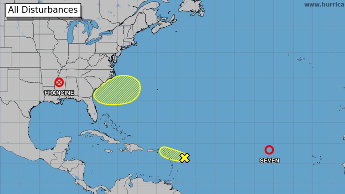
In the days ahead, two areas will be monitored in the Atlantic basin.
One area under watch is a tropical wave in the eastern Caribbean, moving westbound with thunderstorm activity, but lacking any organization. In the short term, conditions are not readily favorable for development, but may become more conducive later in the week.
With a medium chance for development, this could be something to watch closer to the weekend as it nears the Yucatan peninsula.
Another area being monitored is a tropical wave near the Cabo Verde Islands, also with a medium chance for development late week.
Early indications are that if any development occurs, it will be slow in nature. Additionally, a northerly turn out to sea would be highly likely, with no concerns of impact down the road.
Whether or not the season ends up above or below average this year or any other year in the future, I’m indifferent. My singular hope is that you’re always keeping an eye out and are prepared in the event the deck is stacked against us. A season’s true measure isn’t in the final number of storms achieved…it’s simply if you were impacted or not.