
NOAA doubled down on its forecast for a hyperactive hurricane season on Thursday.
The August update to the May seasonal outlook still calls for a grand total of no less than 17 named storms (we’ve had four so far), possibly as many as 20 more during the remainder of the season. Of these, a total of eight to 13 would reach hurricane strength. There have been two hurricanes so far in 2024.
In the all-important major hurricane category, NOAA’s August outlook is forecasting four to seven of these often-catastrophic cyclones. Major Hurricane Beryl was the first this year. Will we see another half-dozen?
Mercifully, sea surface temperature anomalies in the tropical Main Development Region of the Atlantic are about 1 degree Fahrenheit lower, on average, than they were at the beginning of the season. However, that part of the ocean is still 1 degree Fahrenheit hotter than the 1981-2010 average.
The Hurricane season is on. Our meteorologists are ready. Sign up for the NBC 6 Weather newsletter to get the latest forecast in your inbox.

Wind shear through the middle of this month is forecast to be low from a point midway between Africa and the Caribbean to near the Lesser Antilles — about half of the Main Development Region. Should a disturbance form, it will find sufficiently warm water and low wind shear to be able to grow.
That is precisely what seems to be happening as we head into this weekend. A tropical wave over the eastern Atlantic is forecast by several of the global weather forecast models to develop into a tropical depression or storm over the next week. It appears to be aiming for the northeastern Caribbean, but it’s still unknown if it will develop before reaching that region.
Hurricane Season
The NBC 6 First Alert Weather team guides you through hurricane season

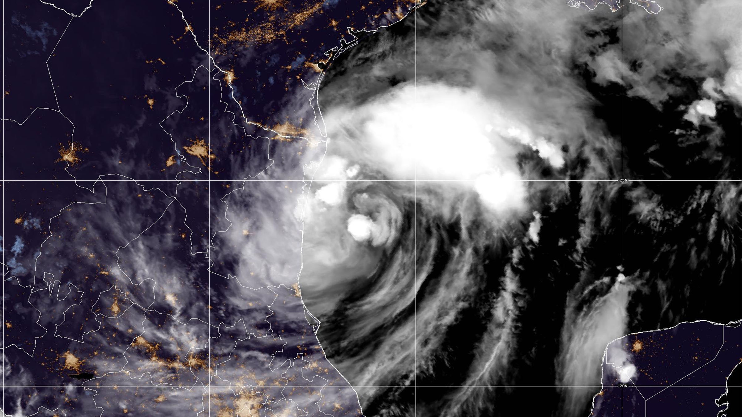
The long-range track of the disturbance is still very uncertain. After passing over or near the Leeward Islands it could turn out to sea or continue moving towards the west-northwest, inching closer to the U.S. in about eight to 10 days.
Compared to what eventually became Hurricane Debby, there will be less hurdles for this disturbance to clear thanks to the aforementioned low wind shear and warm water. According to some computer models, dry air north and west of the system could mix into the fledgling circulation. But Saharan dust outbreaks historically drop off sharply in August.
Because the easterly wave is still southwest of the Cabo Verde Islands, this is nothing to be overly concerned about yet. A lot can happen during its week-long trek across the Atlantic. But it is a reminder that the most active period of the hurricane season is upon us, and it’s forecast to be extraordinarily busy.