
I’m not complaining. Getting past May and almost all of June with only one minor tropical storm isn’t a bad deal considering what had been expected from this hurricane season.
Last week, Tropical Storm Alberto hit near Tampico, Mexico, with 50-mile-per-hour winds and flooding rains. It also brought much-needed rain to south and west Texas.
Having one tropical storm through the end of June is on par with an average Atlantic hurricane season. I’ll take average. But there are signs that the next few weeks are going to set us off on a much more active period.
JOHN MORALES ON HURRICANE SEASON

The Hurricane season is on. Our meteorologists are ready. Sign up for the NBC 6 Weather newsletter to get the latest forecast in your inbox.
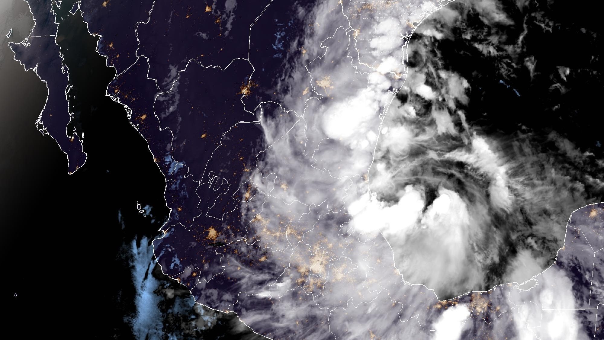
Two tropical waves are being monitored by the National Hurricane Center (NHC) for potential development.
One is already in the western Caribbean Sea southwest of Jamaica and heading west-northwest toward Central America or the Yucatan Peninsula of Mexico. It likely doesn’t have time to coalesce into a named tropical storm before bringing rain to that region.
Central America and Mexico have been baked by a heat dome over the last several weeks with triple-digit temperatures and increased rates of evaporation that had worsened a drought until just recently. Recent relief from the drought would be boosted by this tropical wave, labeled Invest 94L by NHC.
Way out in the Main Development Region of the tropical Atlantic is a new tropical wave that emerged off the African coast a few days ago. Currently southwest of the Cabo Verde Islands, the wave, for the moment, is still disorganized. However, many of the global weather forecast models, including the American, European and Canadian, point to the development of a tropical depression or storm by the first of next month near or just east of the Windward Islands. Those are the islands just north of South America extending from Trinidad-Tobago to the island nation of Dominica.
Conditions will be favorable for the development of this wave in the last few days of June as it travels westbound over the Atlantic. Obviously, the waters are extra warm. Plus, upper-level westerly winds will relax, leading to lessened wind shear above the disturbance.
If it does form, then it’ll have to cross the treacherous eastern Caribbean Sea, known as “hurricane cemetery” because of a historical pattern of sinking and sometimes dry air. Should it do so, Hispaniola could be the next island in its path. But there are still too many “ifs” for us to be worrying about what could happen in the first week of July. The disturbance will be something to monitor going forward.
It's worth noting that the Bermuda-Azores high is strong and sprawling, nosing into Florida from the mid-Atlantic. A large area of Saharan dust is traveling westbound with the trade winds along the southern edge of the high. The Atlantic disturbance, however, sits even further south and away from the main area of dust—giving it a chance to survive or strengthen in the next week or so.
Nothing is imminent in terms of tropical development. But we’ll keep an eye to the south and east for the next week…or the next few months!
John Morales is NBC6's hurricane specialist.
