
Mean Helene is on a mission to be yet another multibillion-dollar disaster.
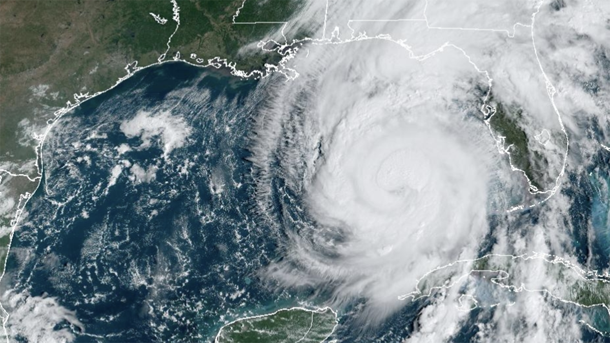
On Thursday afternoon, Helene became a major hurricane amid a rapid intensification (RI) cycle. It is the second time since it formed on Tuesday that maximum sustained windspeeds had increased by at least 35 miles per hour.
Watch NBC6 free wherever you are
In this most recent swift strengthening phase, it went from an 80-mph low-end Category 1 hurricane on Wednesday to a 130 mph Category 4 cyclone on Thursday. Helene is passing over waters that are over 3 degrees Fahrenheit hotter than historical averages, a condition made 600 times more likely by climate change, according to Climate Central’s CSI Ocean index. It is the second major hurricane (Cat 3 or higher) of the 2024 season.
HURRICANE HELENE
Get local news you need to know to start your day with NBC 6's News Headlines newsletter.
The period from 2020 to 2024 goes into the record books, tying the mark for the longest consecutive number of years (5) in which a major hurricane has made landfall in the United States.
Hurricane Helene’s wind field is about as large as they come. The radius of sustained tropical storm force winds stood at just under 350 miles Thursday afternoon. Based on historical averages, that makes this hurricane larger than 90% of tropical cyclones.
Miami’s Opa-Locka airport, located 299 miles away from Helene on Thursday afternoon, experienced a wind gust of 72 mph. Hurricane force winds also extend out an unusually far distance of 60 miles from the eye.
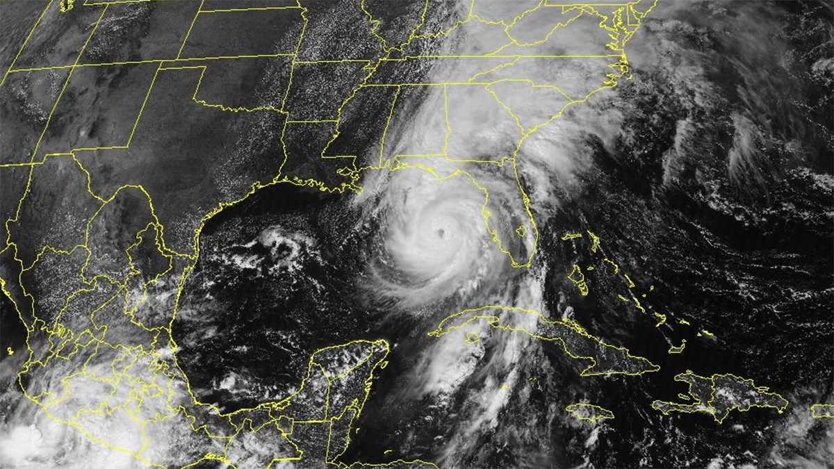
The large wind field is a good part of the reason why the National Hurricane Center is forecasting an “unsurvivable” storm surge. Basically, storm-force winds are blowing south to north across the entire eastern Gulf of Mexico. This long wind fetch drives water towards Florida, with an expected inundation around 8 feet in Tampa Bay, and up to 20 feet in Apalachee Bay.
The concave shape of the coastline between Apalachicola and the mouth of the Suwanee River helps “collect” all that Gulf water, which will be driven even higher because of the depth of the ocean bottom. Waters are shallow in that region because the continental shelf extends out from the Florida Panhandle far out into the Gulf. That means that there isn’t much room to “store” the water being driven towards the coast by the hurricane.
The resulting surge could be immense.
If that wasn’t enough, there is great concern about how far inland damaging winds will reach. Helene’s motion is accelerating, and it’s so huge that it will take quite some time to wind down. Windstorm damage could extend far inland beyond Florida’s capital city of Tallahassee and well into Georgia. Atlanta could see hurricane force wind gusts from Helene.
Plus, biblical rains are forecast in some Southeastern states. Parts of South and North Carolina could experience 30 inches of rain—a big flooding and landslide disaster in the making.
Beyond the short-term suffering from its immediate victims, long term implications include more pressure on FEMA and state-level relief agencies, more fuel for a burgeoning insurance crisis, and more reasons to think twice about building or rebuilding in harms way in a century that looks nothing like the past.
John Morales in NBC6's hurricane specialist.