
Hurricanes feed off of warm ocean waters. What happens then when that ocean heat is made 400 times more likely due to human-caused climate change? You get record-shattering Hurricane Beryl.
Unusually warm ocean temperatures contributed to Hurricane Beryl's rapid intensification. Climate Central’s new Climate Shift Index: Ocean (Ocean CSI) methodology, which quantifies the influence of climate change on sea surface temperatures, found that the storm developed and intensified over waters whose elevated temperatures were made up to 400 times more likely by human-caused climate change.
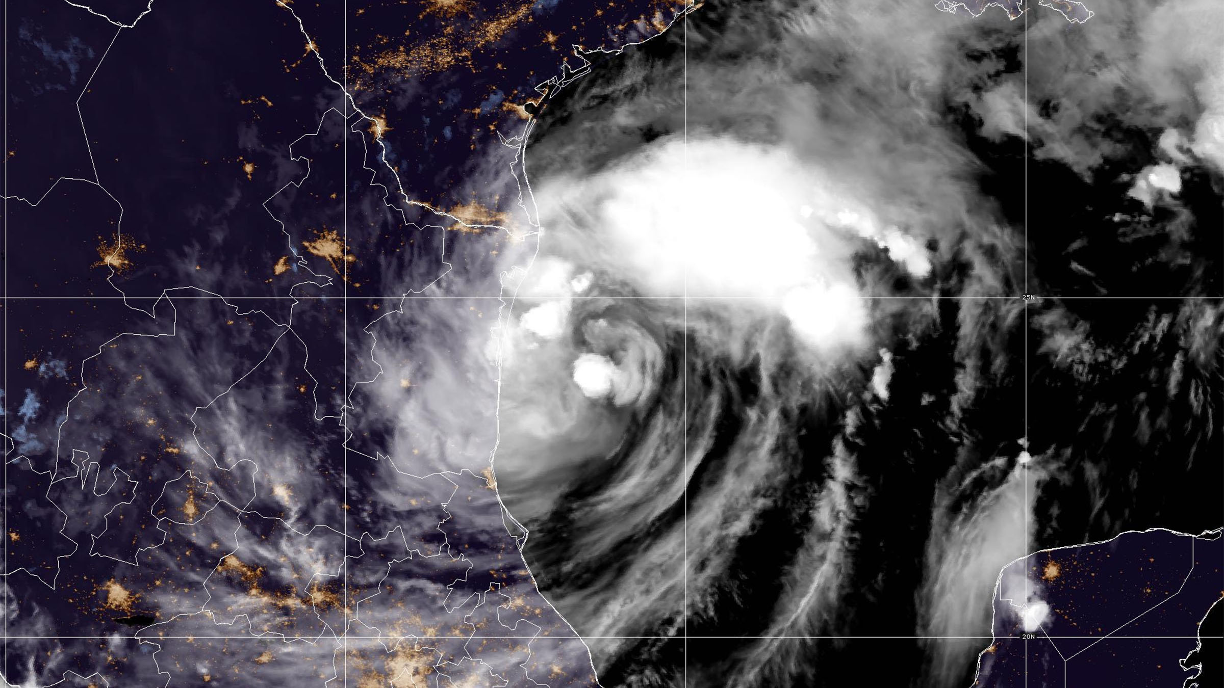
Hurricane Beryl rapidly intensified as it passed over waters that were 2°–3°F warmer than normal. The sea surface temperatures that fueled Hurricane Beryl are typically expected in September, not June. Human-caused climate change made these temperatures 100–400 times more likely.

The Hurricane season is on. Our meteorologists are ready. Sign up for the NBC 6 Weather newsletter to get the latest forecast in your inbox.
“Beryl is a striking illustration that this year’s hurricanes are growing in an environment clearly warmed by human-caused climate change,” says Dr. Daniel Gilford, climate scientist at Climate Central.
Hurricane Beryl was a catastrophic North Atlantic storm during late June through early July 2024. Beryl's development and rapid intensification were facilitated by record-breaking warm ocean conditions and a period of lower-than-average vertical wind shear. Beryl’s maximum winds peaked at approximately 165 mph just west of the Lesser Antilles, making it the earliest season Category 5 hurricane in recorded history. Beryl caused about $6 billion dollars in damages in the U.S. alone and killed at least 60 people during landfalls in the Caribbean, Yucatán Peninsula, and U.S. Gulf Coast.
As ocean temperatures warm in response to climate change, they provide unnatural extra fuel for tropical cyclones to intensify and increase the likelihood that storms will undergo rapid intensification — increasing maximum sustained winds by at least 30 knots (about 35 miles per hour) in a 24-hour period.
Hurricane Season
The NBC 6 First Alert Weather team guides you through hurricane season

It is important to note that the Ocean CSI does not directly quantify how climate change affected Hurricane Beryl’s intensity; instead it speaks to the ocean conditions that allowed Beryl to become a historical and record-breaking storm.
The sea surface temperature over which Hurricane Beryl rapidly intensified was about 1.8°C (3.2°F) warmer than normal (based on the 1991-2020 average). The Ocean CSI indicates these temperatures were made 100–400 times more likely because of human-caused climate change.
This week’s Hurricane Ernesto has been moving over waters that, on average, have been 1.2°C (2.5°F) warmer than the 30-year average. Intensification was held back by dry air and its rapid speed of motion. But it reached hurricane strength north of Puerto Rico on Wednesday and is forecast to become a major hurricane with sustained winds of at least 115 mph before threatening Bermuda this weekend.
Remember, NOAA’s Atlantic hurricane season updated outlook is forecasting four to seven of these often-catastrophic cyclones. Major Hurricane Beryl was the first this year and Ernesto could be the second.