
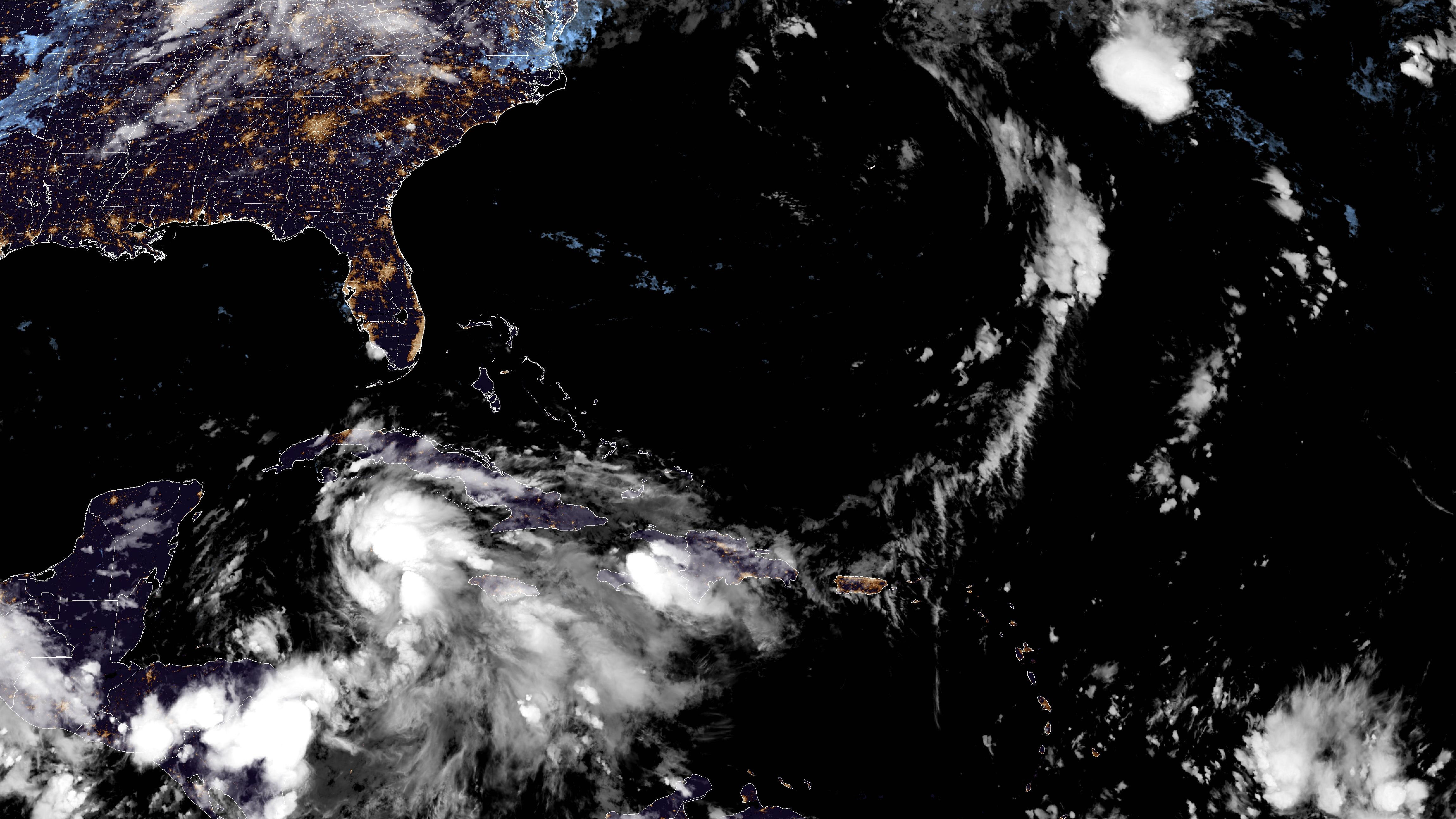
As the next storm of the hurricane season unravels in the northwest Caribbean, look for more watches to be issued along Florida’s coastline throughout the day.
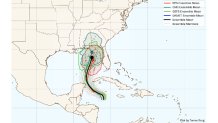
As of Monday evening, the anticipation of Helene had already prompted the issuance of a Tropical Storm Watch for the Lower Florida Keys. Late Monday night, an additional watch was posted for the Southwest coastline of Florida from Bonita Beach to Flamingo.
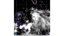
The storm, forecast to become or be close to a major hurricane by the time it reaches the northern Gulf over the next two to three days, is still sputtering in its humble beginnings.
The Hurricane season is on. Our meteorologists are ready. Sign up for the NBC 6 Weather newsletter to get the latest forecast in your inbox.
Once a bit more organization takes shape, the system is due to traverse into the southern Gulf of Mexico, growing an expansive wind field of tropical storm force winds.
As I wrote about last week, the Northwest Caribbean presents exceptionally high ocean heat content, sprawling across the Yucatan Channel and into the Gulf of Mexico. Once a definitive center unfolds and the system matures, there will be plenty of warm water to fuel it.
The overall environment will support intensification to a hurricane tomorrow, with sweeping impacts up the Florida Gulf coast, well outside of the National Hurricane Center’s forecast track.
A large wind radius, prompting the Keys’ Tropical Storm Watch, will push water up the coast over the next few days. This will create surge concerns far away from the eventual landfall position. With that, a Storm Surge Watch is in effect for Florida’s Southwest coastline as well.
While not a direct threat to metro South Florida, its expanding wind field will prove problematic in a host of ways.
Hurricane Season
The NBC 6 First Alert Weather team guides you through hurricane season
Wednesday’s weather will turn breezy, followed by passing rounds of downpours. Some of the heavier and more concentrated downpours could prompt some flooding concerns. While 2 to 4 inches of rain are feasible for the remainder of the week, locally heavier amounts are possible.
In the stronger bands of rain that swing through, wind gusts up to 45 mph will be possible through Thursday, too. Additionally, an elevated risk of rip currents will be expected as marine conditions, generally, remain hazardous.
It’s important to note that a track that may bring the storm a little closer to the peninsula may change the impacts a bit. Please continue to monitor the forecast as “Helene” passes through the Gulf.
Helene will be the 8th named storm of the year. As mentioned, becoming a hurricane by Wednesday would mark the fifth of the season. Should it become a became a major hurricane, it would be just the second to do so.
While model guidance hasn’t changed dramatically regarding just where the storm ends up, fluctuations in the intensity forecast are possible for the next day or two. Focusing strictly on the forecast path only provides a snapshot of what the storm’s impacts will look like. Wind, rain and surge are expected to sweep the Gulf coast as the storm moves south to north. We’ve seen this before…