
Party’s over. It’s back to reality in the Atlantic as the calendar and a still-too-hot ocean converge.
Of course, September starts on Sunday. And Sept. 10 is the historical peak of hurricane season. By this time next week, we’re going to have potentially three areas of concern.
The factors that had brought us the late-August lull are disappearing. That includes the strong east winds aloft that had been causing odd wind shear, and the Saharan Air Layer that had stabilized the Atlantic where tropical waves were.
Despite a couple of long pauses, 2024’s season is still running 71% above normal based on the Accumulated Cyclone Energy. The metric, known by its acronym ACE, takes into account the number of storm days and their intensity. Any new named storms will simply add to an already extraordinary hurricane season.
The Hurricane season is on. Our meteorologists are ready. Sign up for the NBC 6 Weather newsletter to get the latest forecast in your inbox.
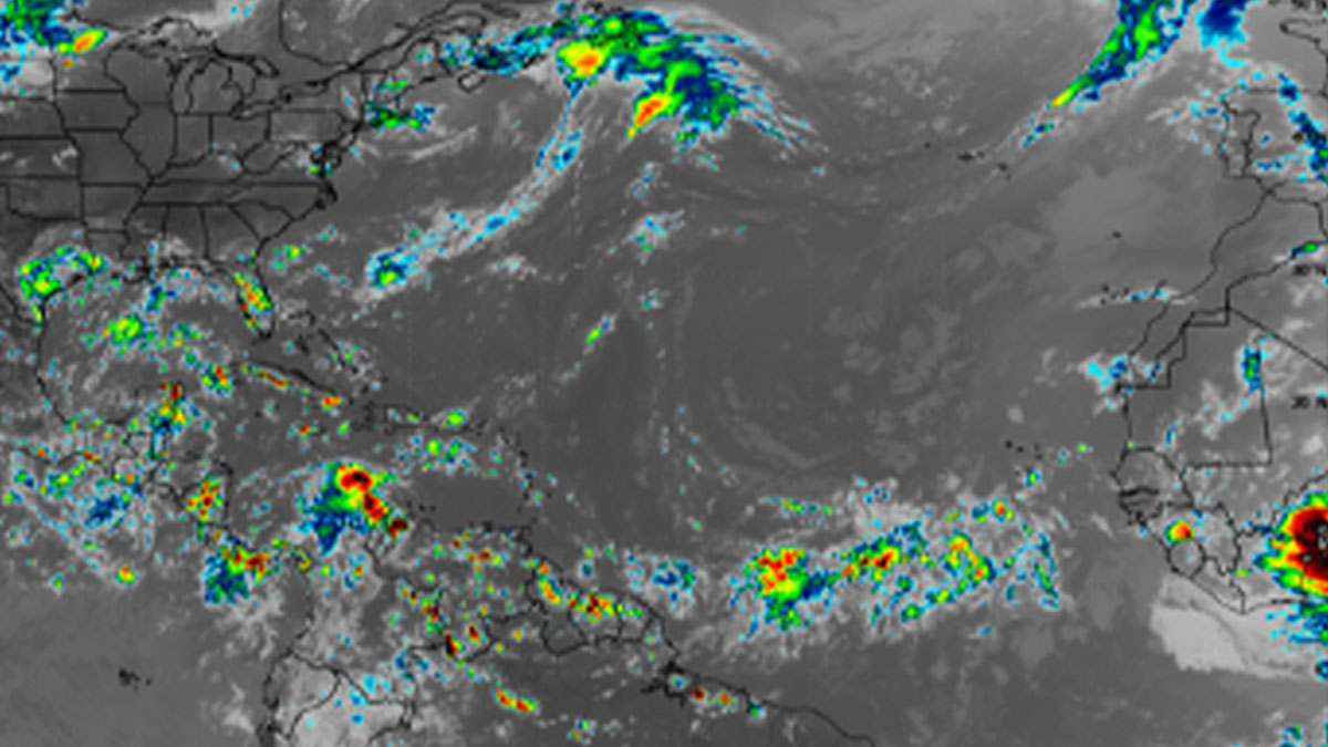
The Atlantic disturbance most likely to develop over the next handful of days could impact the Caribbean, and possibly the southeastern U.S. down the road. Another could emerge from the Yucatan into the Gulf of Mexico. And a third could swing into the open Atlantic after passing south of the Cabo Verde Islands.

Should development occur, it is too soon to tell where and when that disturbance heading into the Caribbean system will congeal. There is a wide region within which the National Hurricane Center (NHC) indicates that there is a medium chance for tropical depression or storm formation. It stretches from the Lesser Antilles to the central Caribbean Sea and as far north as Puerto Rico and the Dominican Republic.
The system’s track will play a major role of what type of threat, if any, it could pose for the United States. If it tangles with the Greater Antilles, interaction with land and mountain ranges would keep the intensity in check. If it tracks over the open waters of the Caribbean, then it will have plenty of hot water to feed off from.
Recall that it was over the Caribbean Sea where Hurricane Beryl attained Category 5 status. Waters made a few degrees Celsius — yes, plural — hotter contributed to Beryl becoming the earliest ever-recorded Cat 5 in the Atlantic basin’s history. The observed hot sea surface temperatures were made hundreds of times more likely because of manmade climate change, according to Climate Central’s Climate Shift Index (CSI)—Ocean.
HURRICANE SEASON
As more of the global weather forecast models start to support the idea of tropical cyclone formation, we’ll see NHC raising the chances for development. Then, as soon as this weekend, Potential Tropical Cyclone Six may be on the map east of the Windward or Leeward Islands.
For those of us who never want to see a hurricane again, the hardest weeks of the year are ahead.