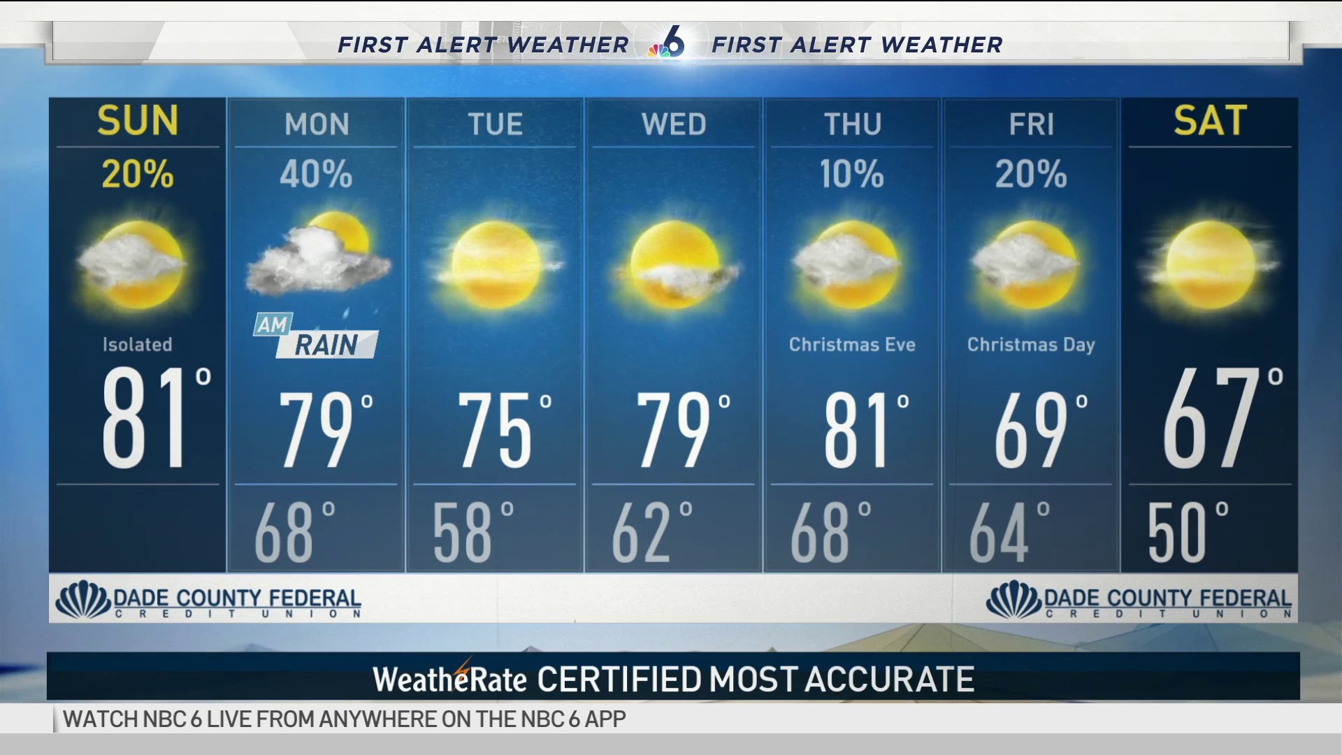
Another cold front is working through South Florida and bringing with it some isolated showers for the first half of the day. By this afternoon, skies will clear and sunshine will follow with brighter skies and temperatures into the upper 70s to low 80s.
Today’s cold front leaves us with upper 50s to low 60s tomorrow morning. Dry skies stick around for the mid-week and temperatures return to 80s by Thursday.
Another front arrives just in time for Christmas Day on Friday. We will wake up to a refreshing change on Christmas morning with lows into the 50s.
So the questions right now: 1) What will be the official high temperature on Friday? It may be in the 70s because the front is a bit slower. 2) What is the ‘actual’ afternoon temperature? Likely to only be in the 60s and falling into the 50s behind the cold front. As long as the ‘official’ high earlier in the day is below 73°, it is the coldest Christmas since 1999.
No doubt the coldest air will be on Friday night into Saturday when lows bottom out in the 40s and highs only reach the 60s. Cool and comfortable conditions will stick around for the upcoming weekend.


