
Debby has become a Category 1 hurricane as it keeps strengthening over the Gulf of Mexico, it sits about 70 miles south-southeast of Tallahassee as of early Monday. It was about 45 miles northwest of Cedar Key.
According to the latest update from the National Hurricane Center, Debby has maximum sustained winds of 80 miles per hour and is expected to strengthen rapidly before making a landfall in the Big Bend region.
Forecasters warned heavy amounts of rain from Debby could spawn catastrophic flooding in Florida, South Carolina and Georgia.
The storm was expected to make landfall around midday Monday in the Big Bend area of Florida, north of Tampa, the hurricane center said. A tornado watch also was in effect for parts of Florida and Georgia until 6 a.m. Monday.
The Hurricane season is on. Our meteorologists are ready. Sign up for the NBC 6 Weather newsletter to get the latest forecast in your inbox.
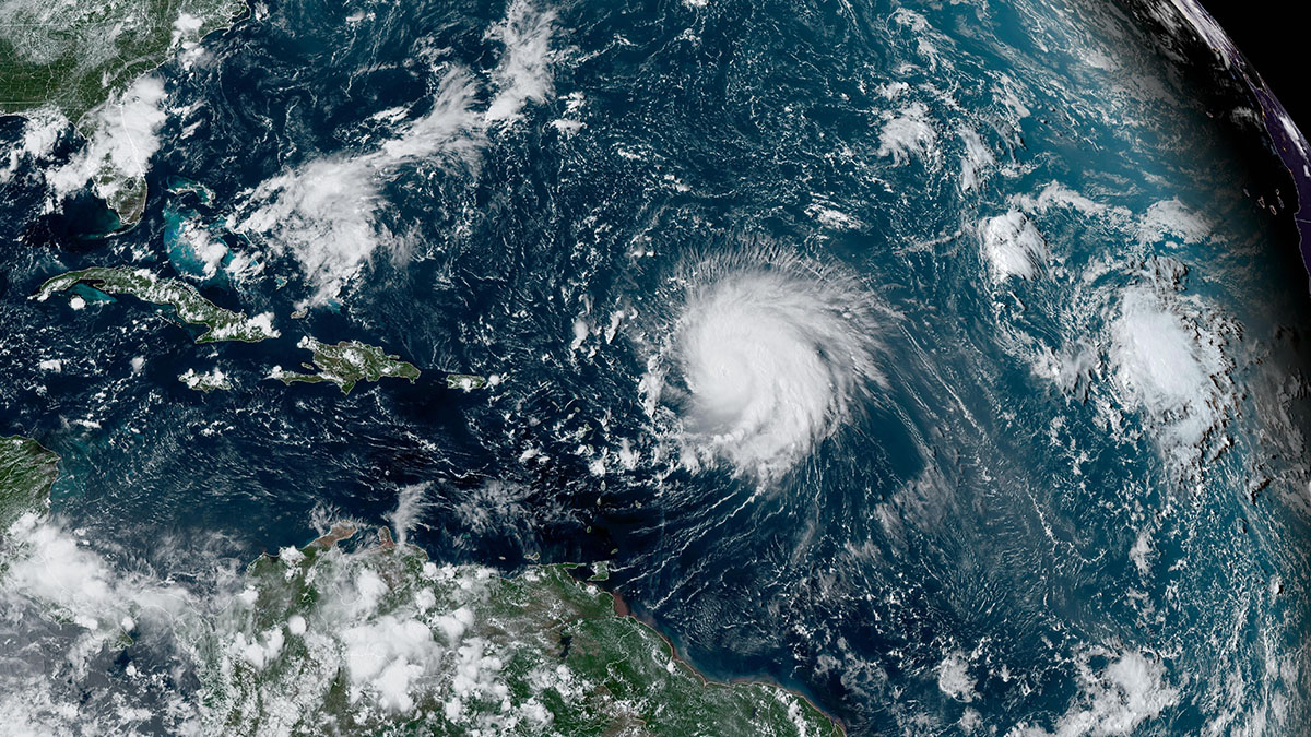
Debby stayed over the open waters through the day on Sunday but impacts will continue, especially for the western side of Florida. The forward movement is slightly slower, at 10 mph.
Debby moved across western Cuba on Saturday as a depression before it reached the eastern Gulf of Mexico, where it reached tropical storm status, the NHC said.
A hurricane warning was in effect for the Florida Gulf coast from the Suwannee River to the Ochlockonee River, while a hurricane watch was in effect for the Florida coast west of the Ochlockonee River to Indian Pass and the Florida coast east of the Suwannee River to Yankeetown.
Heavy wind, rain and flooding were expected along the system's path, with maximum rainfall totals up to 15 inches possible in some areas, the NHC said.
"This rainfall will likely result in areas of locally considerable flash and urban flooding, with river flooding expected," the NHC said.
Impacts in South Florida
Windy weather will continue across our area with gusts 25-35+ mph. This will keep beach hazards in the forecast too. It’ll be hot and humid through the area today when we are not seeing any of the tropical rain. So be mindful of any flags posted at the beach fronts. The surf is choppy and rip currents are expected.
Flood watches remain in effect with the chance for scattered heavy rain and gusty wind throughout the day. Rain accumulations are expected to be between 1-3” with some spots up to 5” across South Florida. This could lead to flooding in urban and poor drainage areas.
HURRICANE SEASON

Isolated tornadoes are going to be possible in the rain bands that work through the area. While there will be more dry time today, there could still be active squalls that move through this afternoon and evening.
Coastal flooding concerns are still ongoing in the middle and lower keys from breaker waves 6 to 8 ft. Conditions will slowly improve for us the further north this system tracks.
Travel has also been impacted. Dozens of flights were cancelled at Miami International Airport due to Debby, according to the airport's communications director.
Travelers are urged to confirm their flight status with airlines before heading to the airport.