
This article is not being updated anymore. Please go here for the latest information on Tropical Storm Debby.
A hurricane warning was in effect for a portion of Florida's Gulf coast Saturday as a tropical depression became Tropical Storm Debby as it made its way toward the state, forecasters said.
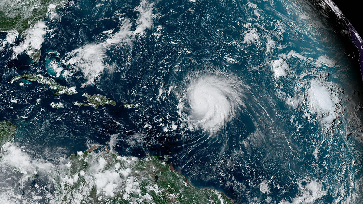
Tropical Storm Debby's maximum sustained winds increased slightly to 40 mph as the system moved northwest about 100 miles west-southwest of Key West, according to the latest update from the National Hurricane Center in Miami.
The Hurricane season is on. Our meteorologists are ready. Sign up for the NBC 6 Weather newsletter to get the latest forecast in your inbox.
Debby moved across western Cuba as a depression before it reached the eastern Gulf of Mexico, where it reached tropical storm status, the NHC said.
Forecasters said slow strengthening on Saturday would be followed by a faster rate of strengthening Sunday through Monday, and the system could be at or near hurricane strength when it reaches the Florida Gulf coast.
The latest potential track from the NHC kept the center of the system to the west of the Florida Keys.
A hurricane warning was in effect for the Florida Gulf coast from the Suwannee River to the Ochlockonee River, while a hurricane watch was in effect for the Florida coast west of the Ochlockonee River to Indian Pass and the Florida coast east of the Suwannee River to Yankeetown.
A tropical storm warning was in effect for the Florida Keys west of the Seven Mile Bridge including the Dry
Tortugas and the west coast of the Florida peninsula from south of the Suwannee River to East Cape Sable.
A tropical storm watch was in effect for the Florida Keys north of the Seven Mile Bridge to the Channel 5
Bridge, and the Florida coast west of Indian Pass to Mexico Beach
Heavy wind, rain and flooding were expected along the system's path, with maximum rainfall totals up to 15 inches possible in some areas, the NHC said.
"This rainfall will likely result in areas of locally considerable flash and urban flooding, with river flooding expected," the NHC said.
Impacts in South Florida
Wind gusts to tropical storm force were occurring over the Florida Keys Saturday morning and other areas in South Florida throughout the day.
The windy conditions and scattered storms will be the highest impacts in South Florida with higher impacts further north.
The Lower Keys can expect wind to be around 30 mph with gusts 40 to 45 mph and choppy surf. Small craft advisories were in place for dangerous conditions on the water. The waves are expected to be 7 feet or higher. Surge in the Lower Keys and Dry Tortugas could be anywhere from 1-2 feet and mainland Monroe could see up to 3 feet.
HURRICANE SEASON

Impacts have already started across all of our area though. We’ve had scattered downpours and some breezy conditions from some of the outer squalls. This is to be expected throughout the day Saturday.
This could lead to some flooding concerns in areas that see round after round of rain. A flood watch has been issued for all of South Florida through Sunday evening. Rainfall totals look to be between 2-5 inches with some areas getting up to 8 inches for the weekend. Even higher totals are expected on the western side of Florida.
There is also the possibility that these squalls have a few rotating cells. Isolated tornadoes that are quick moving are also possible. While the threat is low, it’s not zero for these spin ups to occur.