For decades, drug runners and their potential connections to terrorist groups have been a constant concern of law enforcement and military leaders at the U.S. Southern Command in Doral.
Now, the cartels are going to have a tougher time hiding, and that is in part because of what is happening almost 400 miles above the earth.
The U.S. Space Force, which has only been around for two years, is sending satellites into orbit on many days from Cape Canaveral.
The Hurricane season is on. Our meteorologists are ready. Sign up for the NBC 6 Weather newsletter to get the latest forecast in your inbox.
Some head into orbit over the Caribbean, Central and Latin America — where drug lords have for years produced and then shipped cocaine and marijuana into the U.S. by using waterways in and around South Florida.
NBC 6 was granted exclusive access to see how space, ground, and sea forces are using what the satellites provide.
“We are trying to find the narcotraffickers and space is a big contributor to that,” said Air Force Lt. Gen. Andy Croft, the Military Deputy Commander at Southern Command.
Local
“We can use our space detection capabilities, optical cameras,” Croft told NBC 6. “We can track things within a couple of hours and see things moving.”
That includes being able to see what’s happening in places like Colombia and Venezuela, where intelligence experts fear drug traffickers and terrorist groups will join forces.
Around the clock, space and intelligence experts are sharing what they find.
Inside a room at Southern Command, there is a big screen that shows where the satellites are located. There is also a host of workstations where space experts can explain what they are seeing to representatives from the military and federal agencies.
“Space Command can provide a perspective to be able to identify and find some of these folks, the ways that they communicate, the ways they move,” said Lt. Col. Bobby Schmitt, who is with the U.S. Space Force and is assigned to coordinate what happens in orbit with Croft’s team. “Space Command provides the ability to see down and find these folks.”
The efforts are lightyears from the days of the cocaine cowboys when violence poured into the Miami streets along with the cocaine.
Croft said the images from the satellites are a valuable resource.
“We can get multiple images in the same day of the same area. So, an aircraft would have to fly many, many missions to do the same thing at a very high cost. Whereas we can utilize that satellite imagery and also share it,” Croft said.
For example, when satellites pick up a runway popping up in the middle of nowhere.
“We can identify those airstrips from space, tell our partner nations where they are so they can go then interdict those—the narcotraffickers,” Croft told NBC 6.
He said the technology allows them to stop traffickers on the ground and at sea.
“The fast vessels they use to transport the drug, which about 90% of the drugs come via the maritime environment and we will be able to assist those nations to go interdict those drug runners that are many cases hundreds of miles out to sea,” Croft explained.
Closer to Florida, it’s the Coast Guard that moves in when the word comes.
Pilot Lt. Cmdr. Jason Neiman is the Coast Guard’s Public Affairs Officer.
“Any information we get is crucial when we use our assets which are limited in resources to target these nefarious networks and get them where they are most vulnerable on the high seas,” Neiman said.
Other federal agencies can also get the information—like the U.S. Customs and Border Protection to stop human smuggling.
“It’s really, really important and it’s growing rapidly our capabilities,” Croft said.
Brazil is the furthest along in Latin America with its space program.
When Disaster Strikes
Sharing this information with countries and federal agencies goes beyond tracking down criminals.
The coordination protects satellites used for banking and navigation. It also helps when a natural disaster strikes.
“That image quality is super helpful in assisting partner nations, especially in disaster response,” Croft told NBC 6.
Croft said the technology helped his team’s efforts in Haiti last Summer.

“In the Haitian earthquake that we just responded … we can use previous digital imagery, and then new digital imagery to see where a lot of the destruction occurred and where areas need to be fixed or repaired. That quality of that imagery is getting better every, every year that we continue on,” he said.
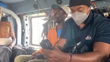
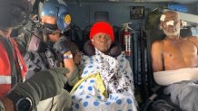
NBC 6 was onboard Coast Guard helicopters as they left Port-au-Prince and headed for rural areas in the days after the earthquake to evacuate the injured and bring supplies.
NBC 6 didn’t know then, but it was one of the satellites launched by the U.S. military that helped the Coast Guard figure out where to go.

“Information is everything, particularly when you are responding to a disaster, especially in remote and isolated places where information sharing can be difficult,” Neiman said. “You know when you have emerging technology that can make that easier that make our mission safer and make our mission effectiveness better and you know we use any information we can to help save lives in a disaster situation.”
“It’s really good to know that we are making a difference day to day,” Croft added.


